|
Then and Now

 West Point Pike Toll House

|
|
|
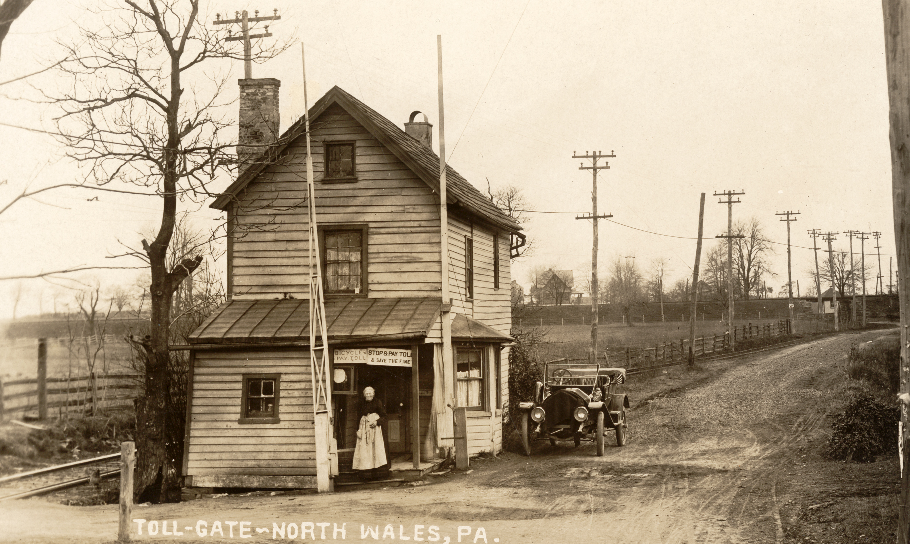
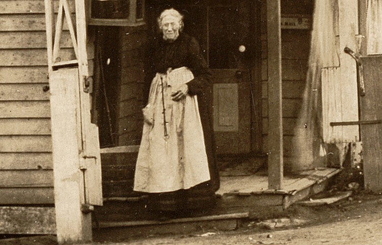
Toll House at West Point Pike and Sumneytown Pike, circa 1908. |
|
The gate on the left of the woman (Margaret Rhoads) would have
been across West Point Pike when it was down. The gate to the
right of her would have been across Sumneytown Pike. The
Stony Creek Railroad tracks are in the background.
Did Margaret drive to work? She lived in the toll
house. The Ford model T could belong to the photographer. However, if it
belonged to the photographer why is there a blanket over the radiator?
(See larger version of photo.) |
|
Click on the photo for a larger version.
Photo thanks
to Mike Szilagyi |
|
|
| |
|
|
|
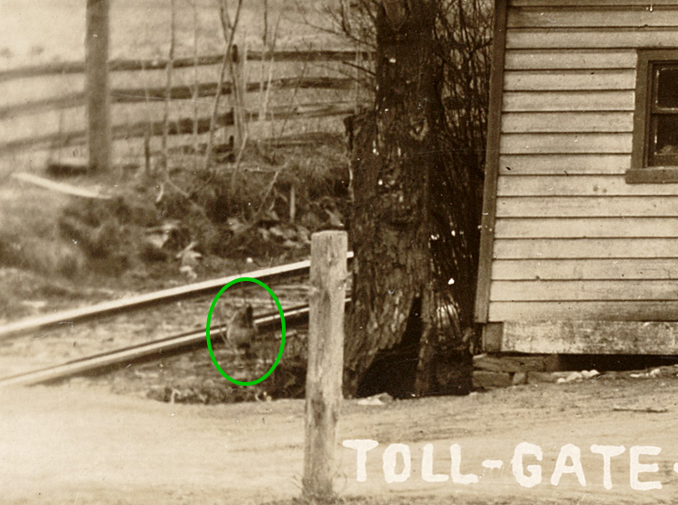
There are some other interesting
things in the photo. It's a cold, overcast day, probably in late
winter. On the left, what initially appears to be a fence are the trolley tracks of the Montgomery Traction Company, which
had a stop nearby at "Wales Junction." The foundation of the
house looks like its about to slide into a ditch, and a chicken
is looking into the camera. |
|
| |
2014 |
|
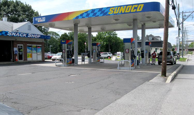
Behind the man gassing up his car is
The Sumney, at
the intersection of the two pikes. One might wonder
why
the picture is of a gas station and not The Sumney if it was taken
from the intersection. The explanation is that the intersection was moved
in the 1960s to align
it with Church Road. |
|
|
|
|
|
1960 |
|
In this photo West Point Pike hasn't been moved
yet and enters the picture left-center. The toll booth would
have been near the car in the center of the photo, but more than
likely would have been in the middle of the southbound lane of
Sumneytown Pike, since it has been widened. Photo taken from
Sumneytown Pike. |
|
|
Photo thanks to Dick Shearer |
|
|
|
|
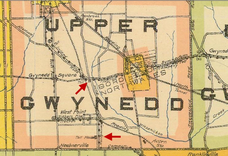
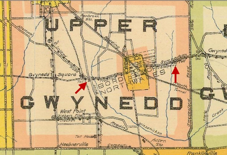
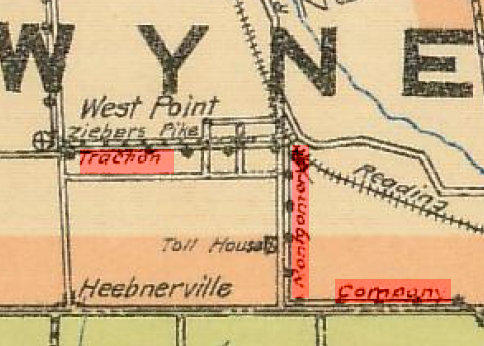
Location of the toll houses on West Point Pike. This map is from 1912.
|
|
|
|
Location of the toll houses on Sumneytown Pike. |
|
|
|
|
|
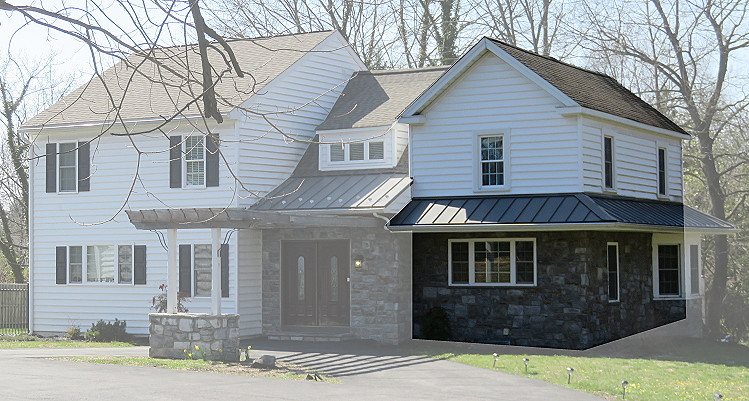
The tollhouse south of North Wales on Sumneytown Pike
exists to this day. This was the Van Fossen tollhouse,
presumably because the family running it was named Van Fossen. Decades ago it had been moved back from the
road. In 2017 a large addition was built onto it. |
|
|
|
|
|
|
"Montgomery Traction Company" is written in a very confusing manner on
the map. This was the trolley car line that ran between Lansdale and
Norristown from 1902 till 1911. Garfield Avenue is named "Ziebers Pike"
on the map. It is
thought that Garfield Avenue may be named after President James A. Garfield,
who was assassinated on July 2, 1881
|
|
|
|
|
|
Margaret Rhoads collected tolls from 1855 until her death in 1911.
The "Springhouse and Sumneytown Turnpike" ceased operation in 1914. |
|
|
|

|
|

|