|
Then and Now

 Feed Mill and Hay Press

|
|
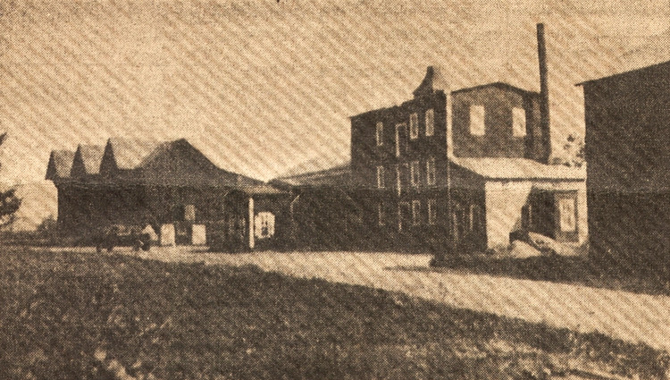
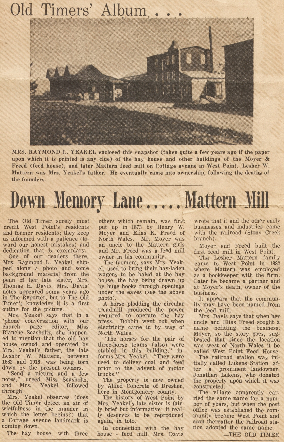
Left: L. W. Mattern's hay house, on Cottage Avenue, built after 1881. Center
and right: Mill and feed house
built by
Henry Moyer and Elias K. Freed as the "West Point Feed House" sometime
around 1873. |
|
2014 |
|
|
|
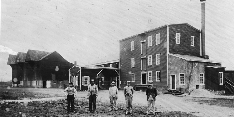
Mattern's hay press site. It was one of
the largest hay presses in Montgomery County. Who are the people in the
picture? The man on the left is Lesher Mattern! This dates the
photograph to sometime between 1905 and 1918.
The smoke stack tells
us there was a steam engine in the brick section of the mill building. Click on the photo for
full size. |
|
|
. Photos thanks to Bob Moyer, great
grandson of Henry Moyer. |
|
|
|
|
|
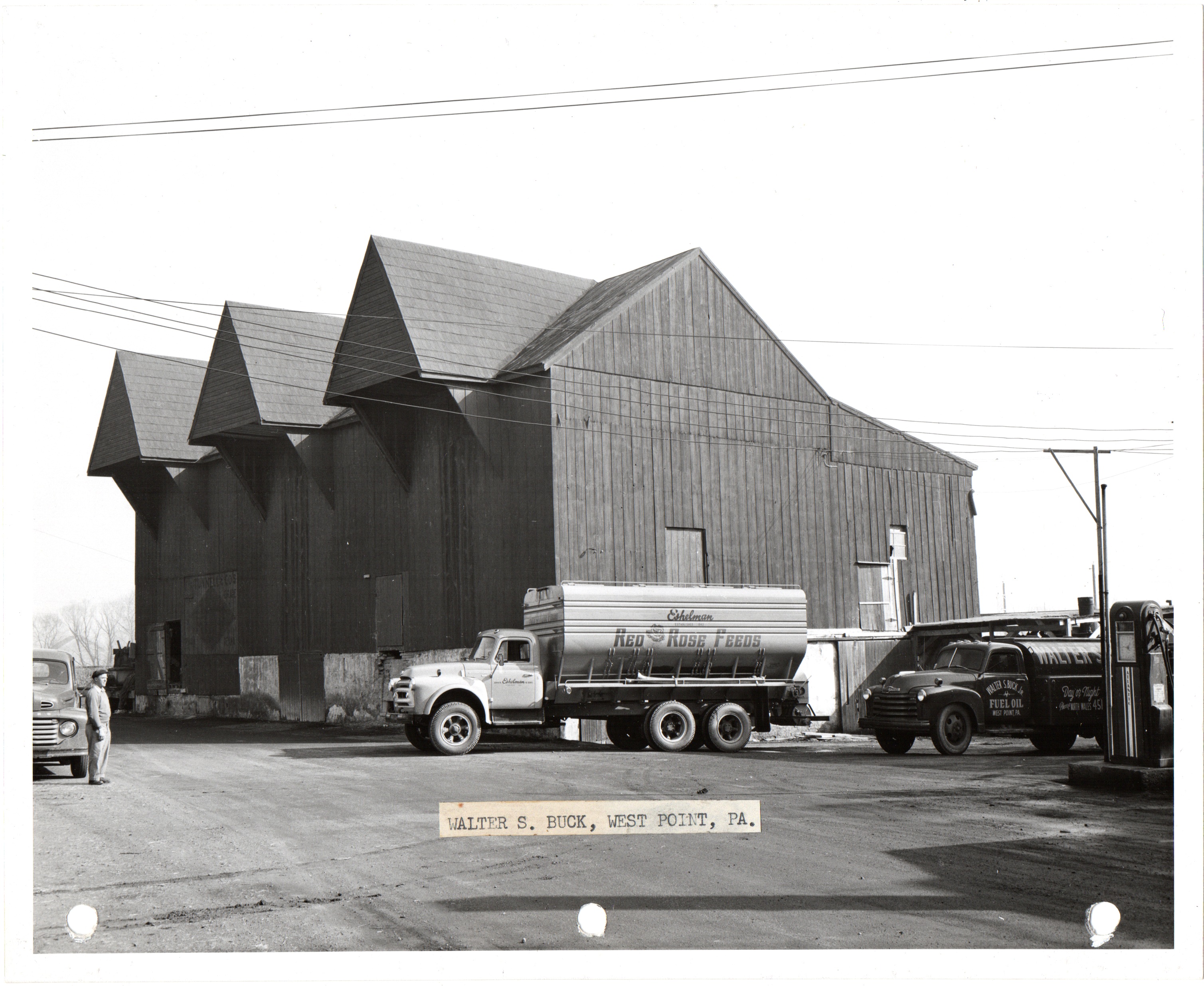
Trucks show the scale of the large hay pressing building.
Click on photo for
full size. |
|
|
|
|
|
2014 |
|
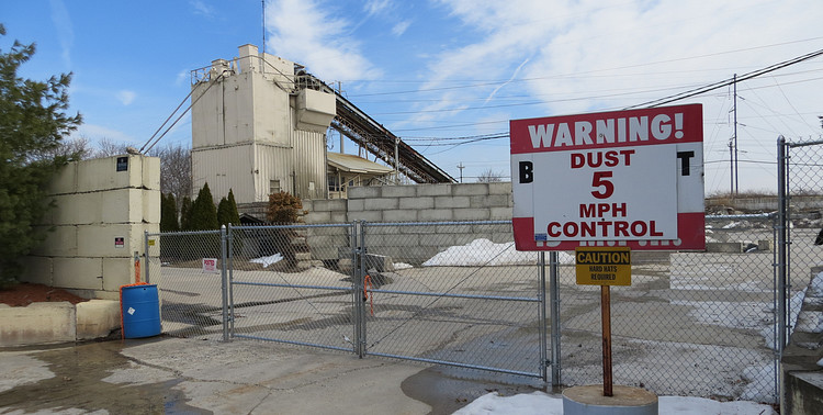
Allied Concrete bought the mill property on
January 1,1961. In 1967 the mill and hay house were demolished, leaving the brick building standing to this day.
However, it may also soon be demolished. On April 12, 2012
Allied sold the property to Anchor Road Associates and it has
been vacant for years (as of 2016). Learn more in the
"History" section.
|
|
|
|
|
|
|
|
Click on the picture to read an informative article
written by Lesher Mattern's daughter. |
|
|
|
|
|
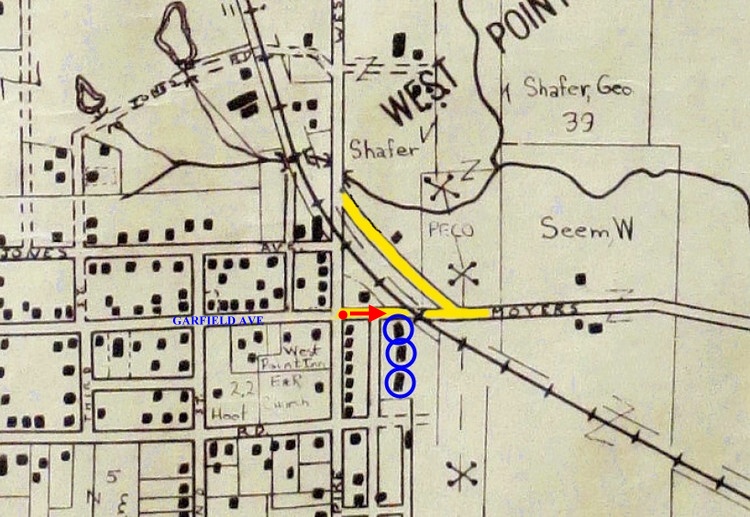
As far back as the 1960's Moyers Road crossed the train
tracks in line with Garfield Avenue. The Feed House complex is circled
in blue. Moyers Road (now Moyer Boulevard) probably started out as a pair
of Henry Moyer's wagon wheel tracks through the woods, taking him from
his grist mill in North Wales to the "West Point" feed house.
Click on map for an expanded view. |
|
|
|
|
|
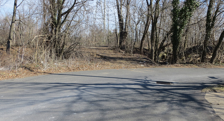
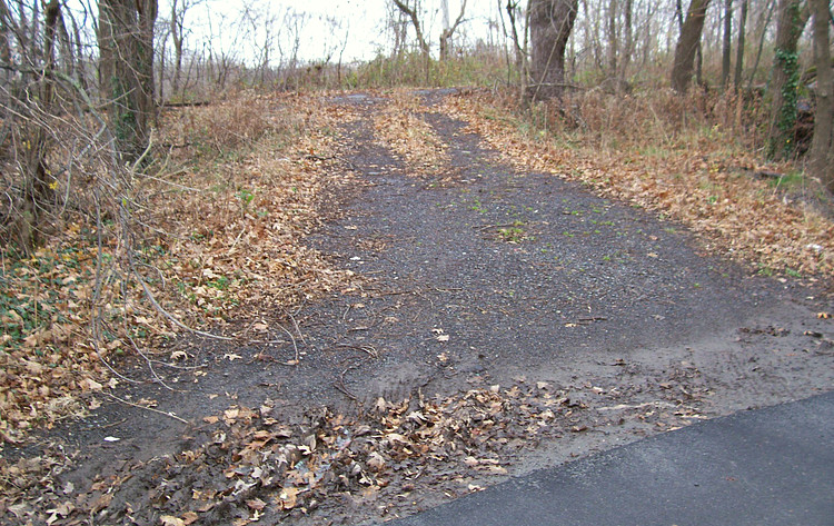
| We are standing on the red dot on the
map, looking in the direction of the arrow. This part of Moyers Road
still exists as of March 2016. It is the cleared ramp-like area in the
center between the groups of trees. It shows signs of recent use.
Surveyors have been down here staking out the property lines of Allied
Concrete. |
|
|
|
|
|
|
This how it looked in 2006. Not much has changed in ten
years. |
|
|
|
|
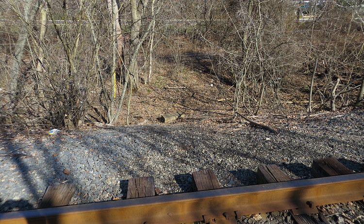
| Walking up the ramp and looking down on
the other side of the tracks, there is no sign of the road at all. This
is actually rather steep. Obviously the railroad doesn't want people
crossing the tracks here. |
|
|
|
|
|
|
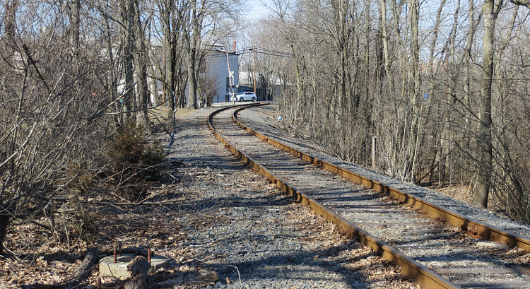
Looking to the left from the same spot, a car crosses the tracks on West
Point Pike at the site of the old train station. |
|
|
|
|
|
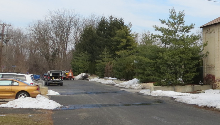
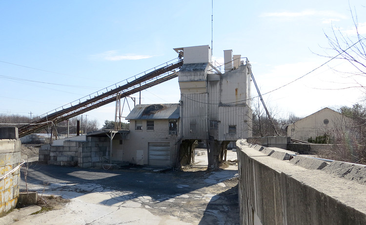
A few feet to the right and we are
looking down at the abandoned Allied Concrete plant, in the very spot
the hay house once occupied. |
|

|
|

|